
קובץ:Turcici imperii imago 01-map (FL10521761 2716583) (cropped).jpg

גודל התצוגה המקדימה הזאת: 800 × 593 פיקסלים. רזולוציות אחרות: 320 × 237 פיקסלים | 640 × 474 פיקסלים | 1,024 × 759 פיקסלים | 1,280 × 948 פיקסלים | 2,560 × 1,897 פיקסלים | 11,537 × 8,549 פיקסלים.
לקובץ המקורי (11,537 × 8,549 פיקסלים, גודל הקובץ: 93.61 מ"ב, סוג MIME: image/jpeg)
| זהו קובץ שמקורו במיזם ויקישיתוף. תיאורו בדף תיאור הקובץ המקורי (בעברית) מוצג למטה. |
תקציר
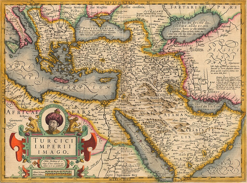
| Jodocus Hondius I: Turcici imperii imago
|
|||||||||||||||||||||||||||||||||||||
|---|---|---|---|---|---|---|---|---|---|---|---|---|---|---|---|---|---|---|---|---|---|---|---|---|---|---|---|---|---|---|---|---|---|---|---|---|---|
| עורך |
|
_(cropped).jpg) | |||||||||||||||||||||||||||||||||||
| כותרת |
Turcici imperii imago |
||||||||||||||||||||||||||||||||||||
| מפרסם | |||||||||||||||||||||||||||||||||||||
| סוג אובייקט |
antique map / מפה מאויירת ביד / early world maps / מפה היסטורית |
||||||||||||||||||||||||||||||||||||
| סוגה |
מפה |
||||||||||||||||||||||||||||||||||||
| תיאור |
Turcici imperii imago. |
||||||||||||||||||||||||||||||||||||
| שפה |
לטינית |
||||||||||||||||||||||||||||||||||||
| תאריך יצירה |
בסביבות / המאה ה-17 |
||||||||||||||||||||||||||||||||||||
| תאריך הוצאה לאור |
possibly / 1606 |
||||||||||||||||||||||||||||||||||||
| טכניקה | 1 map : col ; | ||||||||||||||||||||||||||||||||||||
| ממדים |
גובה: 48 ס"מ |
||||||||||||||||||||||||||||||||||||
| אוסף |
|
||||||||||||||||||||||||||||||||||||
| מיקום נוכחי |
|
||||||||||||||||||||||||||||||||||||
| מיקום הוצאה |
אמסטרדם |
||||||||||||||||||||||||||||||||||||
| הערות |
Probably from Mercator's Atlas.; On verso text in Latin, p. 342, signum Rrrrrrr. | ||||||||||||||||||||||||||||||||||||
| IE PID | IE10521759 | ||||||||||||||||||||||||||||||||||||
| רוזטה שם קובץ | FL10521761 | ||||||||||||||||||||||||||||||||||||
| מזהה רשומה בספרייה הלאומית (P3959) | 990027165830205171 | ||||||||||||||||||||||||||||||||||||
| סימוכין | Anna Contadini, The Renaissance and the Ottoman World | ||||||||||||||||||||||||||||||||||||
| קובץ זהויות | |||||||||||||||||||||||||||||||||||||
| מקור/צלם |
|
||||||||||||||||||||||||||||||||||||
| גרסאות אחרות | |||||||||||||||||||||||||||||||||||||
| חיפוש בקטלוג מרחב | Turcici imperii imago | ||||||||||||||||||||||||||||||||||||


.jpg)
_(cropped2).jpg)
_(cropped).jpg)
_(cropped).jpg)
_(cropped).jpg)

_(cropped).jpg)
_(cropped).jpg?uselang=he)
רישיון
The copyright situation of this work is theoretically uncertain, because in the country of origin copyright lasts 70 years after the death of the author, and the date of the author's death is unknown. However, the date of creation of the work was over 120 years ago, and it is thus a reasonable assumption that the copyright has expired (see here for the community discussion). Do not use this template if the date of death of the author is known.
| |
| הקובץ הזה זוהה כקובץ חופשי מכל מגבלה ידועה תחת חוק זכויות היוצרים, כולל כל הזכויות הקשורות והסמוכות. | |
היסטוריית הקובץ
ניתן ללחוץ על תאריך/שעה כדי לראות את הקובץ כפי שנראה באותו זמן.
| תאריך/שעה | תמונה ממוזערת | ממדים | משתמש | הערה | |
|---|---|---|---|---|---|
| נוכחית | 14:03, 21 ביולי 2023 | | 8,549 × 11,537 (93.61 מ"ב) | Geagea | c:User:Rillke/bigChunkedUpload.js: =={{int:filedesc}}== {{Artwork |artist = |author = |title = Turcici imperii imago |description = Turcici imperii imago. |language = | date = |publication date = |medium = 1 map : col ; |dimensions = |institution = |department = {{Institution:National Library of Israel}} |place of publication = |object history = |exhibition history = |credit line = |inscriptions = |notes = Probably from Mercator's Atlas.; On verso text in Lat... |
שימוש בקובץ
הדף הבא משתמש בקובץ הזה:
שימוש גלובלי בקובץ
אתרי הוויקי השונים הבאים משתמשים בקובץ זה:
- שימוש באתר fr.wikipedia.org
- שימוש באתר www.wikidata.org
_(cropped).jpg)