לדלג לתוכן

קובץ:Great Glen Project Station M - geograph.org.uk - 818230.jpg

תוכן הדף אינו נתמך בשפות אחרות.
מתוך ויקיפדיה, האנציקלופדיה החופשית

Great_Glen_Project_Station_M_-_geograph.org.uk_-_818230.jpg (640 × 480 פיקסלים, גודל הקובץ: 27 ק"ב, סוג MIME‏: image/jpeg)

ויקישיתוף זהו קובץ שמקורו במיזם ויקישיתוף. תיאורו בדף תיאור הקובץ המקורי (בעברית) מוצג למטה.

תקציר

תיאור
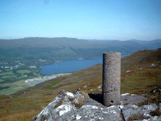
English: Great Glen Project Station M This triangulation pillar was one of around sixteen built for a special survey of the Great Glen in the 1970s. These pillars were not part of the retriangulation of Great Britain and therefore do not appear on any maps. Cylindrical trig pillars were referred to by the OS as 'Vanessa' columns. This pillar has OSBM flush bracket number 11881. The photograph overlooks Fort Augustus and the SW end of Loch Ness. These hills are very rough terrain but the panoramic views are well worth the effort.
תאריך יצירה
מקור From geograph.org.uk
יוצר Graeme Paterson
ייחוס
(required by the license)
InfoField
Graeme Paterson / Great Glen Project Station M / 
Graeme Paterson / Great Glen Project Station M
מיקום המצלמה57° 07′ 04.72″ N, 4° 39′ 42.8″ W  Heading=0° Kartographer map based on OpenStreetMap.תמונה זו ותמונות נוספות במיקום: OpenStreetMapinfo
מיקום האובייקט57° 07′ 04.88″ N, 4° 39′ 42.8″ W  Heading=0° Kartographer map based on OpenStreetMap.תמונה זו ותמונות נוספות במיקום: OpenStreetMapinfo

רישיון

w:he:Creative Commons
ייחוס שיתוף זהה
הקובץ הזה מתפרסם לפי תנאי רישיון קריאייטיב קומונז ייחוס-שיתוף זהה 2.0 כללי.
ייחוס: Graeme Paterson
יש לך חופש:
  • לשתף – להעתיק, להפיץ ולהעביר את העבודה
  • לערבב בין עבודות – להתאים את העבודה
תחת התנאים הבאים:
  • ייחוס – יש לתת ייחוס הולם, לתת קישור לרישיון, ולציין אם נעשו שינויים. אפשר לעשות את זה בכל צורה סבירה, אבל לא בשום צורה שמשתמע ממנה שמעניק הרישיון תומך בך או בשימוש שלך.
  • שיתוף זהה – יצירת רמיקס, שינוי או בנייה על סמך החומר הזה, תטיל עליך חובה להפיץ את התרומות שלך לפי תנאי רישיון זהה או תואם למקור.

כיתובים

נא להוסיף משפט שמסביר מה הקובץ מייצג

פריטים שמוצגים בקובץ הזה

מוצג

57°7'4.717"N, 4°39'42.840"W

אזימוט: 0 מעלה

28,131 בית

480 פיקסל

640 פיקסל

image/jpeg

checksum אנגלית

27ebcea7fe68927d7d8cb78f623024e1c11b0319

היסטוריית הקובץ

ניתן ללחוץ על תאריך/שעה כדי לראות את הקובץ כפי שנראה באותו זמן.

תאריך/שעהתמונה ממוזערתממדיםמשתמשהערה
נוכחית14:09, 20 בפברואר 2011תמונה ממוזערת לגרסה מ־14:09, 20 בפברואר 2011‪480 × 640‬ (27 ק"ב)GeographBot== {{int:filedesc}} == {{Information |description={{en|1=Great Glen Project Station M This triangulation pillar was one of around sixteen built for a special survey of the Great Glen in the 1970s. These pillars were not part of the retriangulation of Grea

הדף הבא משתמש בקובץ הזה:

שימוש גלובלי בקובץ

אתרי הוויקי השונים הבאים משתמשים בקובץ זה:

מטא־נתונים