
קובץ:GPS Satellite NASA art-iif.jpg

גודל התצוגה המקדימה הזאת: 748 × 599 פיקסלים. רזולוציות אחרות: 300 × 240 פיקסלים | 599 × 480 פיקסלים | 1,006 × 806 פיקסלים.
לקובץ המקורי (1,006 × 806 פיקסלים, גודל הקובץ: 111 ק"ב, סוג MIME: image/jpeg)
| זהו קובץ שמקורו במיזם ויקישיתוף. תיאורו בדף תיאור הקובץ המקורי (בעברית) מוצג למטה. |
תקציר
| תיאור |
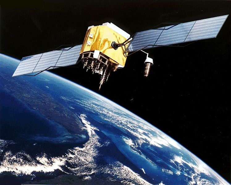
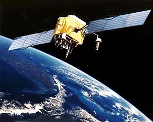
English: Artist's conception of GPS Block II-F satellite in Earth orbit.
Français : Vue d'artiste d'un satellite GPS Block II-F sur orbite terrestre. |
| תאריך יצירה | תאריך בלתי־ידוע |
| מקור | https://www.egraphicbd.com [dead link] (Wayback Machine) |
| יוצר | NASA |
| גרסאות אחרות |

רישיון
| קובץ זה נמצא ברשות הציבור מכיוון שהוא נוצר על ידי נאס"א. מדיניות זכויות היוצרים של נאס"א קובעת ש"חומרים של NASA אינם מוגנים בזכויות יוצרים אלא אם צוין אחרת". (דף מדיניות זכויות היוצרים ב-NASA או מדיניות שימוש בתמונות ב-JPL). | ||
 |
אזהרות:
|
היסטוריית הקובץ
ניתן ללחוץ על תאריך/שעה כדי לראות את הקובץ כפי שנראה באותו זמן.
| תאריך/שעה | תמונה ממוזערת | ממדים | משתמש | הערה | |
|---|---|---|---|---|---|
| נוכחית | 23:20, 9 בפברואר 2006 | | 806 × 1,006 (111 ק"ב) | Michaelfavor~commonswiki | Artist Interpretation of GPS satellite, image courtesy of NASA http://www.navcen.uscg.gov/ftp/gps/ggeninfo/gps-iif.tif |
שימוש בקובץ
הדף הבא משתמש בקובץ הזה:
שימוש גלובלי בקובץ
אתרי הוויקי השונים הבאים משתמשים בקובץ זה:
- שימוש באתר af.wikipedia.org
- שימוש באתר ar.wikipedia.org
- שימוש באתר ba.wikipedia.org
- שימוש באתר be.wikipedia.org
- שימוש באתר bn.wikipedia.org
- שימוש באתר cs.wikipedia.org
- שימוש באתר cv.wikipedia.org
- שימוש באתר da.wikipedia.org
- שימוש באתר de.wikinews.org
- שימוש באתר el.wikipedia.org
- שימוש באתר en.wikipedia.org
- Navigation
- Dynamic positioning
- Geoinformatics
- Militarisation of space
- GPS signals
- Wikipedia:WikiProject Systems/List of images of systems
- Talk:USA-193
- Help talk:Table/Archive 3
- List of equipment of the United States Armed Forces
- Error analysis for the Global Positioning System
- User:Doggitydogs/GPS
- User:HelpingWorld/sandbox2
- User:Wikiworkr/sandbox
- User:MYBOIIII/sandbox
- Portal:Geodesy
- שימוש באתר en.wikibooks.org
- שימוש באתר en.wikiversity.org
- שימוש באתר es.wikipedia.org
- שימוש באתר es.wikinews.org
- שימוש באתר et.wikipedia.org
- שימוש באתר fa.wikipedia.org
- שימוש באתר fi.wikipedia.org
- שימוש באתר fr.wikipedia.org