
קובץ:Bristol map 1946.jpg
גודל התצוגה המקדימה הזאת: 645 × 599 פיקסלים. רזולוציות אחרות: 258 × 240 פיקסלים | 517 × 480 פיקסלים | 827 × 768 פיקסלים | 1,102 × 1,024 פיקסלים | 2,204 × 2,048 פיקסלים | 4,960 × 4,608 פיקסלים.
לקובץ המקורי (4,960 × 4,608 פיקסלים, גודל הקובץ: 3.75 מ"ב, סוג MIME: image/jpeg)
| זהו קובץ שמקורו במיזם ויקישיתוף. תיאורו בדף תיאור הקובץ המקורי (בעברית) מוצג למטה. |
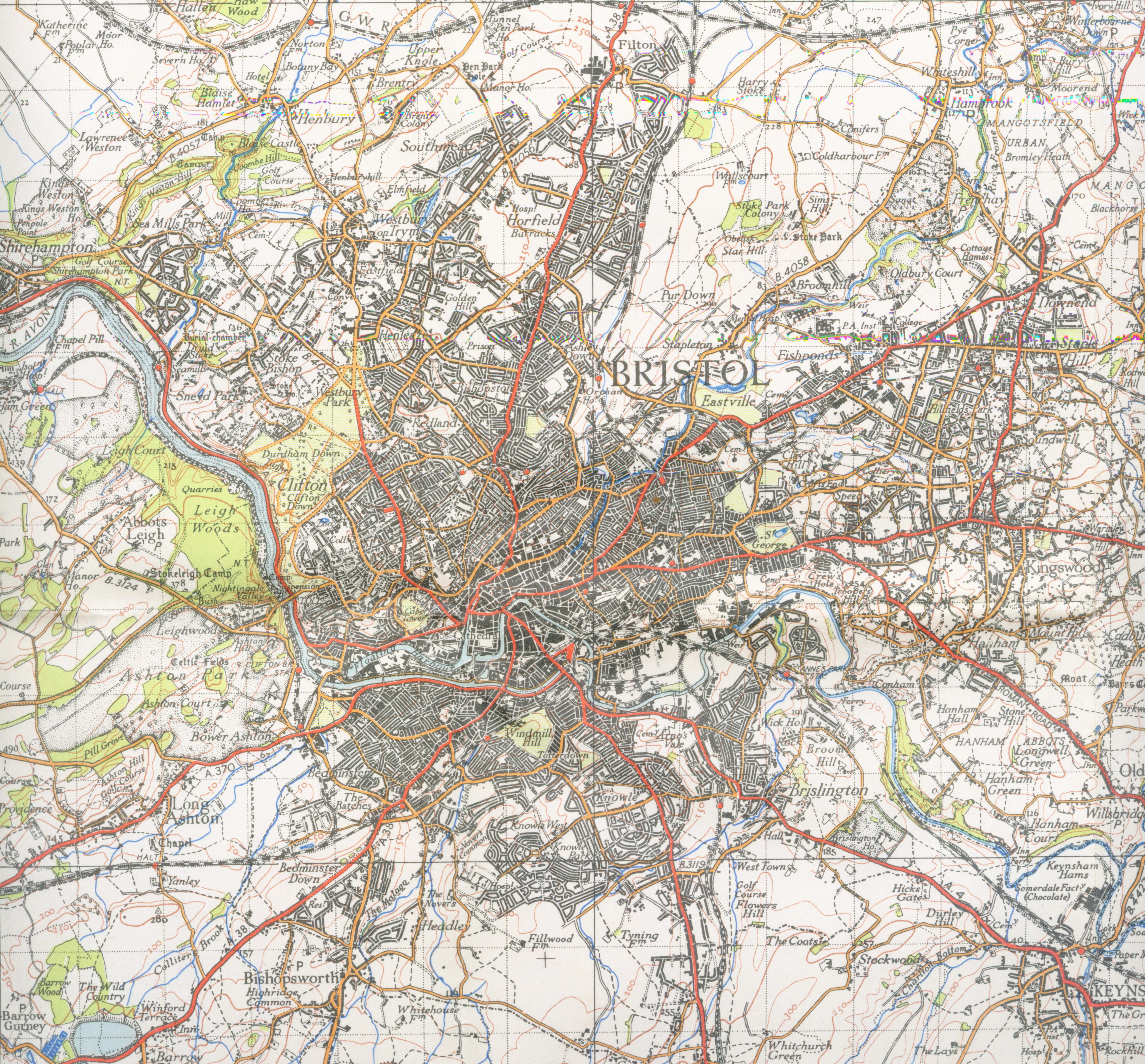
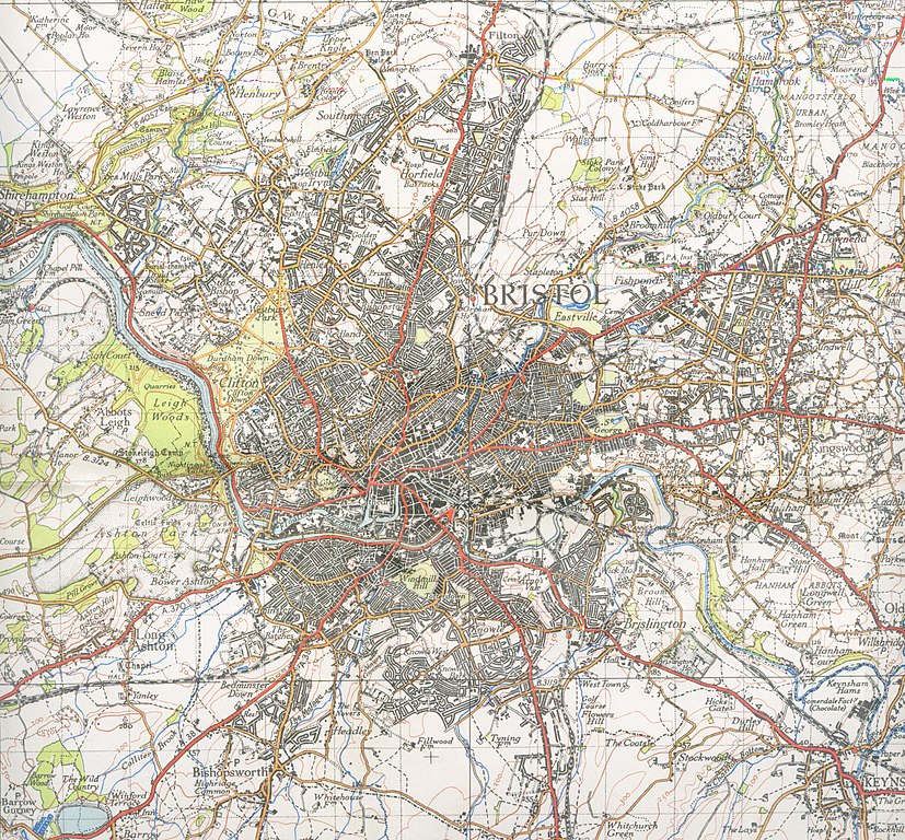
| תיאור | Map of Bristol from 1946. Scale 1 inch to the mile 600DPI Sheet 156 | ||||
| תאריך יצירה | |||||
| מקור | OS | ||||
| יוצר | OS | ||||
| אישורים והיתרים (שימוש חוזר בקובץ זה) |
|

| מיקום המצלמה | | תמונה זו ותמונות נוספות במיקום: OpenStreetMap |
|---|
היסטוריית הקובץ
ניתן ללחוץ על תאריך/שעה כדי לראות את הקובץ כפי שנראה באותו זמן.
| תאריך/שעה | תמונה ממוזערת | ממדים | משתמש | הערה | |
|---|---|---|---|---|---|
| נוכחית | 01:10, 2 בדצמבר 2007 | | 4,608 × 4,960 (3.75 מ"ב) | Geni | trying again |
| 20:20, 16 בספטמבר 2007 |  | 4,800 × 4,352 (3.39 מ"ב) | Geni | {{Information |Description=Map of Bristol from 1946. Scale 1 inch to the mile 600DPI Sheet 156 |Source=OS |Date=1946 |Author=OS |Permission=none needed |other_versions= }} {{oldOS}} Category:Maps of cities in the United Kingdom Category:Bristol |
שימוש בקובץ
הדף הבא משתמש בקובץ הזה:
שימוש גלובלי בקובץ
אתרי הוויקי השונים הבאים משתמשים בקובץ זה:
- שימוש באתר azb.wikipedia.org
- שימוש באתר en.wikipedia.org
- שימוש באתר kn.wikipedia.org