
קובץ:P-Africa.svg

גודל התצוגה המקדימה הזאת מסוג PNG של קובץ ה־SVG הזה: 609 × 599 פיקסלים. רזולוציות אחרות: 244 × 240 פיקסלים | 488 × 480 פיקסלים | 781 × 768 פיקסלים | 1,041 × 1,024 פיקסלים | 2,081 × 2,048 פיקסלים | 1,123 × 1,105 פיקסלים.
לקובץ המקורי (קובץ SVG, הגודל המקורי: 1,123 × 1,105 פיקסלים, גודל הקובץ: 336 ק"ב)
| זהו קובץ שמקורו במיזם ויקישיתוף. תיאורו בדף תיאור הקובץ המקורי (בעברית) מוצג למטה. |
תקציר
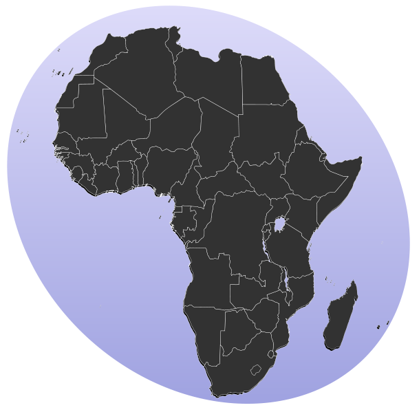
| תיאור | Blank map of Africa Detailed SVG map with grouping enabled to connect all non-contiguous parts of a country's territory for easy colouring. Smaller countries can also be represented by larger circles to show their data easier. All countries are tagged by their ISO code. A thorough description of use and other instructions can be found on the instruction page for the World map. The circles used to mark small countries have been reduceed in size compared to BlankMap-World6.svg, also Gambia does not have a circle in this version. For completion, per en:Africa#Territories and regions, Madeira (pt-30), Canary Islands (es-cn), Réunion (re), Mayotte (yt) and Saint Helena (sh) have been added to the map. Ceuta and Melilla were not added since they don't exist in BlankMap-World6.svg. To make these territories transparent simply use the style .sh, .pt-30, .es-cn, .yt, .re {opacity: 0;} | ||
| תאריך יצירה | (UTC) | ||
| מקור |
קובץ זה הוא יצירה נגזרת של : BlankMap-Africa.svg: |
||
| יוצר |
|
||
| SVGהתפתחות | , or with something else. Inkscape עם נוצרה ה גרפיקה וקטורית
|
רישיון
| היצירה הזאת שוחררה לנחלת הכלל על־ידי היוצר שלה, Lokal_Profil. זה תקף בכל העולם. יש מדינות שבהן הדבר אינו אפשרי על פי חוק, אם כך: |
יומן העלאה מקורי
This image is a derivative work of the following images:
- File:BlankMap-Africa.svg licensed with PD-user
- 2011-11-08T13:50:11Z Htonl 1000x1000 (188219 Bytes) South Sudan has been allocated ISO code SS; change class and id correspondingly
- 2011-07-09T21:38:33Z Lokal_Profil 1000x1000 (188235 Bytes) Fixed code. Essentialy reverted and readded south sudan manually
- 2011-07-09T17:09:06Z Seb az86556 1000x1000 (189357 Bytes) +South Sudan
- 2010-07-18T16:04:42Z Stephen Morley 1000x1000 (189216 Bytes) Fixed errors that made SVG invalid
- 2009-09-22T16:22:54Z Lokal_Profil 1000x1000 (188987 Bytes) Reverted to version as of 00:54, 3 April 2008; the new map contains none of the iso code and css abilities of the original
- 2009-09-22T15:11:08Z NuclearVacuum 1000x1000 (360040 Bytes) minor change
- 2009-09-22T15:06:20Z NuclearVacuum 1000x1000 (360239 Bytes) Fixed map so it shows surrounding countries as well as making the code valid
- 2008-04-03T00:54:00Z Lokal_Profil 1000x1000 (188987 Bytes) reunion, saint helena, madeira and canary islands (mayotte already in) added for completion
- 2008-04-01T00:21:58Z Lokal_Profil 1000x1000 (185868 Bytes) Made circles smaller, and circular. They were the right size for the world map but to big for the Africa only map
- 2008-03-31T23:55:20Z Lokal_Profil 1000x1000 (185877 Bytes) Removed circle for gambia, not needed for Africa only map
- 2008-03-24T03:09:01Z Lokal_Profil 1000x1000 (186084 Bytes) {{Information |Description=Blank map of Africa Detailed SVG map with grouping enabled to connect all non-contiguous parts of a country's territory for easy colouring. Smaller countries can also be represented by larger circl
Uploaded with derivativeFX
היסטוריית הקובץ
ניתן ללחוץ על תאריך/שעה כדי לראות את הקובץ כפי שנראה באותו זמן.
| תאריך/שעה | תמונה ממוזערת | ממדים | משתמש | הערה | |
|---|---|---|---|---|---|
| נוכחית | 16:31, 18 בינואר 2012 | | 1,105 × 1,123 (336 ק"ב) | Amirki | סיני |
| 22:22, 17 בינואר 2012 |  | 1,068 × 1,079 (337 ק"ב) | Amirki | . | |
| 22:20, 17 בינואר 2012 |  | 1,000 × 1,000 (337 ק"ב) | Amirki | == {{int:filedesc}} == {{Information |Description=Blank map of Africa Detailed SVG map with grouping enabled to connect all non-contiguous parts of a country's territory for easy colouring. Smaller countries can also be represented by larger circles to s |
שימוש בקובץ
הדפים הבאים משתמשים בקובץ הזה:
- שיחה:אפריקה
- שיחה:ארצות הברית של אפריקה
- שיחה:גאוגרפיה של אלג'יריה
- שיחה:גאוגרפיה של סאו טומה ופרינסיפה
- שיחה:היסטוריה של אפריקה
- שיחה:היסטוריה של סאו טומה ופרינסיפה
- שיחה:כלכלת אפריקה
- שיחה:כלכלת סאו טומה ופרינסיפה
- שיחה:לוחמים אפריקאים בצבא צרפת במלחמת העולם השנייה
- שיחה:סאו טומה ופרינסיפה
- שיחה:סלום
- שיחה:פאן-אפריקניות
- שיחה:פוליטיקה של אתיופיה
- שיחה:פוליטיקה של סאו טומה ופרינסיפה
- שיחה:צפון אפריקה
- משתמש:Amirki/גלריה
- משתמש:Ariel196/פורטל:אפריקה
- משתמש:Ariel196/פורטל:אפריקה/מבוא
- משתמש:Avishay
- ויקיפדיה:מיזמי ויקיפדיה/אפריקה
- ויקיפדיה:סדנה לגרפיקה/ארכיון 21
- תבנית:משתמש מיזם אפריקה
- תבנית:ערך ממיזם אפריקה
- פורטל:פורטלים/סמלי פורטלים
שימוש גלובלי בקובץ
אתרי הוויקי השונים הבאים משתמשים בקובץ זה:
- שימוש באתר als.wikipedia.org
- שימוש באתר be-tarask.wikipedia.org
- שימוש באתר bg.wikipedia.org
- Африка
- Серенгети
- Египет
- Мозамбик
- Ангола
- Древен Египет
- Кампала
- Сервал
- Нок
- Северен жираф
- Огун
- Нигерия
- Орания
- Хаутенг
- Бенин
- Демократична република Конго
- Кабо Верде
- Намибия
- Танзания
- Архаичен период на Египет
- Ново царство
- Сеута
- Бушмени
- Птах
- Майот
- Муамар Кадафи
- Канарски острови
- Сръчен човек
- Мелиля
- Реюнион
- Сехмет
- Френска Западна Африка
- Сирт
- Карнак
- Книга на мъртвите (Древен Египет)
- Арабски халифат
- Гиза (област)